Transportation Planning
Transportation planning is commonly considered to be limited to efforts made to improve personal vehicular traffic patterns. However, transportation planning also includes planning for greenways, sidewalks, buses and trains, and other alternative modes of transportation. The Town of Butner often works with Granville County, Kerr-Tar Regional Planning Organization (RPO) and Capital Area Metropolitan Planning Organization (CAMPO) on various transportation-related projects.

East Lyon Station Road Greenway
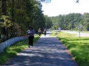
This trail is part of a long range plan for pedestrian and bicycle connections throughout Butner and connecting to other trails in Granville County as part of the Granville Greenways system. The trail runs 0.6 miles along East Lyon Station Road starting at the Food Lion Shopping Center and ending at Telecom Drive.

East Lyon Station Road to Pond Drive Greenway
Completed in 2015, this 1/2 mile trail provides access to about one mile of passive recreation on the eastern side of Town by connecting to the existing East Lyon Station Road Greenway. The Town envisions extending this trail up to NC 56 with a pedestrian crossing at or near the Dollar General.

East Lyon Station Road Greenway Extension
This portion will extend just past Three Wishes and will be approximately 0.42 miles in length. This extension will make the greenway approximately 1.5 miles in length from Three Wishes to Pond Drive. This project is at or near 90% design phase. The Town envisions extending this trail all the way down East Lyon Station Road to Gate Two Road.

West Lyon Station Road Realignment
As part of the Gateway Small Area Plan and with the help by NC DOT, the Town has been working on a plan to realign West Lyon Station Road to further encourage development within the Gateway. Due to specific constraints, the new road needs to be equidistant from both the railroad and I-85. This project is now under the direction of NC DOT (TIP Project No. U-6020). Construction is expected to begin in 2020. Project information and materials can be viewed as they become available here.

East End Connector
The North Carolina Department of Transportation (NC DOT) is building the East End Connector in Durham County to provide a direct connection between the Durham Freeway (NC 147) and Miami Blvd. (US 70) – two major east-west highways in the Triangle – and improved access to I-85 and I-40. The project includes building a 1.25-mile freeway from NC 147 to US 70 and converting 2.75 miles of US 70 to a freeway.
This project is expected to promote economic development in areas along the I-85 corridor toward Virginia and major employment and retail centers, including Research Triangle Park, Raleigh-Durham International Airport and Wake County. Improvements should alleviate congestion on the Durham Freeway through downtown Durham and will help divert traffic off local roads, such as US 15-501 – often used as a connection between I-85 and I-40 – and Roxboro, Mangum, Gregson, and Duke Streets. Construction on NC 147 is expected to be completed and open to traffic in July 2019. US 70 and NC 98 improvements are expected to be open to traffic in May 2020. For updated information on this regional project, please visit NC DOT’s website.

Comprehensive Transportation Plan
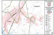
The Granville County Comprehensive Transportation Plan (CTP) was adopted in May 2018. It is a long range plan, which identifies major transportation improvement needs and develops long term solutions for the next 25-30 years. This plan is a joint effort between Butner, Creedmoor, Oxford, Stem, Stovall, Granville County, NC DOT – Transportation Planning Branch (TPB), CAMPO, and KTRPO. The study includes alternative modes of transportation, such as transit, walking and biking. Learn more information about this project.

NC 56 Corridor Study
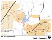
The Town partnered with the City of Creedmoor, Granville County and CAMPO for the NC 56 Corridor Study project. VHB Engineering NC, P.C. helped guide and execute this study. The study encompassed 4.5 miles from 33rd Street in Butner through Creedmoor to the east. Currently a typical two-lane roadway, NC 56 presents transportation challenges given its topography, multiple land uses, poor access management, substantial truck volumes, and traffic volumes ranging from 15,000 to 9,000 vehicles per day. There are no facilities for bicycle and pedestrian access. The study created an integrated strategy of short-term operational improvements, long-range infrastructure investments, and coordinated land use/development policies in order to preserve and enhance the corridor’s environmental resources and economic vitality. For more information and a copy of the study, visit CAMPO’s website.
